
Business
‘Grief Burns Like Fever’: This novel is a flashback of depravity during the surreal pandemic years
October 10, 2026
3,447 views
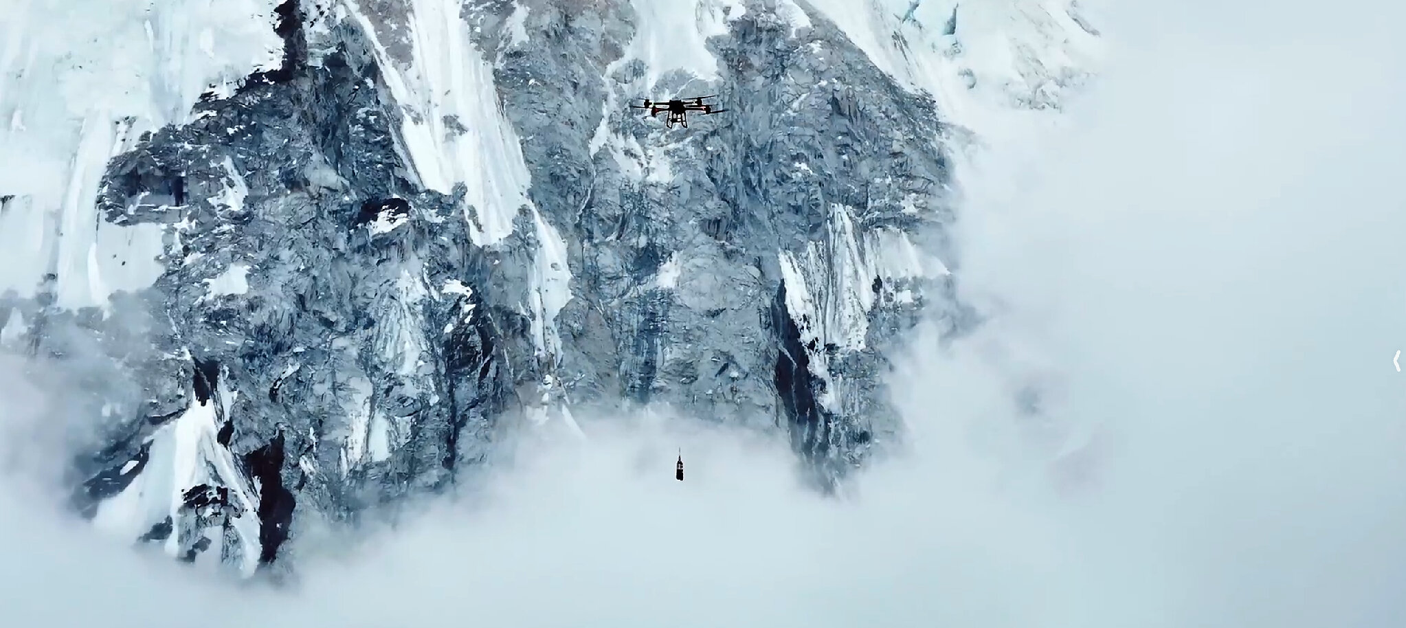
SHENZHEN, China, July 9, 2026 /PRNewswire/ -- DJI, the global leader in civilian drones and creative camera technology, today announced the successful completion of three missions on Mount Qomolangma (also known as Mount Everest), advancing breakthroughs in high-altitude delivery, mapping, and climate research applications. These pioneering missions mark a significant milestone in the utilization of drone technology in extreme environments, showcasing DJI's commitment to innovation and environmental stewardship.
Mount Qomolangma, towering at 8,848.86 meters above sea level, presents unique challenges for any form of technology, especially drones. The thin air, extreme weather conditions, and rugged terrain make it a testing ground like no other. DJI's team of engineers and pilots undertook these missions with a clear objective: to explore the capabilities of drones in conditions that mimic the harsh realities faced by climbers and researchers in high-altitude environments.
During the missions, DJI utilized its latest drone models equipped with advanced features designed for stability and reliability in extreme conditions. The drones were tasked with various objectives, including delivering essential supplies to research stations and capturing high-resolution aerial images for mapping purposes.
One of the most pressing challenges in high-altitude expeditions is logistical support. Traditional methods of transport are often hindered by treacherous trails and unpredictable weather. DJI's successful delivery missions suggest that drones could revolutionize this aspect of high-altitude adventures. By providing timely supplies to climbers and researchers, drones can ensure that critical resources are available when they are needed most.
During the tests, DJI drones successfully delivered medical supplies and high-energy food packs to climbers stationed at critical points along the mountain. The speed and efficiency of these deliveries signal a promising future for drone applications in remote and inaccessible areas.
Mapping the terrain of Mount Qomolangma is crucial for both climbers and researchers studying climate change. The data collected through aerial imagery can provide insights into glacial movements, weather patterns, and environmental changes over time. DJI's drones are equipped with high-resolution cameras and advanced mapping software that allow for the creation of detailed topographical maps.
By employing drones for mapping purposes, researchers can gather data that would be extremely challenging, if not impossible, to collect through traditional means. This technology not only enhances our understanding of the mountain's geography but also plays a vital role in ongoing climate research. As glaciers continue to retreat due to global warming, having accurate data is essential for scientists to monitor changes and predict future impacts on the environment.
The implications of DJI's drone missions extend beyond logistics and mapping; they also contribute significantly to climate research. The high-altitude environment of Mount Qomolangma makes it an ideal location for studying atmospheric conditions and their effects on climate change. Drones can be utilized to collect data on temperature, humidity, and air quality, which are critical variables in understanding climate dynamics.
Through collaboration with climate scientists, DJI aims to develop specialized drones that can operate autonomously in harsh conditions, collecting valuable data without the need for human intervention. This innovation could open new avenues for climate research, allowing for continuous monitoring and real-time data collection in some of the world's most challenging environments.
As DJI continues to push the boundaries of drone technology, the successful missions on Mount Qomolangma serve as a testament to the potential applications of drones in various fields. The insights gained from these missions will inform future developments in drone design, focusing on improving endurance, payload capacity, and autonomous navigation capabilities.
Looking ahead, DJI envisions a future where drones play a central role in not only adventure sports but also in humanitarian efforts, environmental monitoring, and scientific research. By leveraging their expertise in drone technology, DJI aims to contribute to solutions that address some of the most pressing challenges facing our planet today.
DJI's groundbreaking missions on Mount Qomolangma highlight the transformative potential of drone technology in high-altitude environments. With applications ranging from logistical support to climate research, these advancements are setting the stage for a new era of exploration and understanding. As the world faces increasing environmental challenges, the role of drones in monitoring and mitigating these issues will only grow in importance.
In conclusion, DJI's commitment to innovation and sustainability is paving the way for a future where drones are integral to our efforts in exploring and preserving the planet.


Loading more news...
You've reached the end of our news feed. Check back later for more updates!